
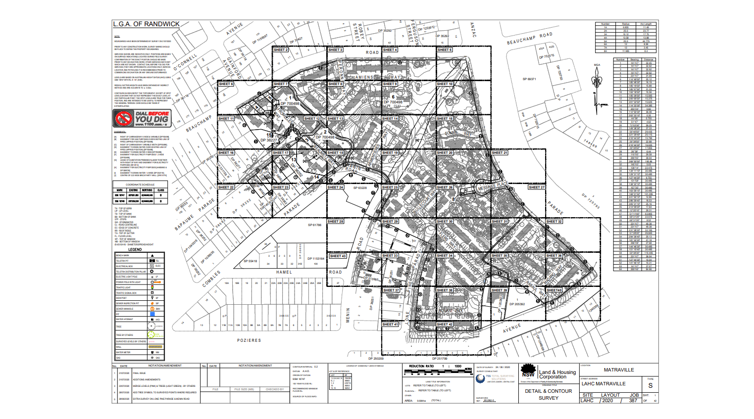
Soldiers Settlement Matraville | NSW
Located in Sydney’s east, this post-WW1 housing estate which was redeveloped in the 1980s was left without good transport and pedestrian links nor a modern public domain.
Project Type: Cadastral, Geospatial & Civil
Details: The site was owned by 3 different groups (LAHC, Randwick Council & the Aboriginal Housing Office). The LAHC, Land and Housing Corporation NSW, as the primary owner engaged TSS to assist with the master-planning of the site for a multi-scoped redevelopment.
Total Solution: As experts in title investigations, our cadastral team provided robust advice with respect to ownership, rights and the impacts of the proposed road changes to ensure the estate’s transport links would meet the changing needs of the community.

Moree Local Aboriginal Land Council | NSW
Conseth Solutions engaged TSS to deliver feature surveys of Stanley Village and Mehi Crescent Moree. The Aboriginal settlements were constructed by the Aboriginal Welfare Board in 1967.
Project Type: Cadastral, UAV & Scanning
Details: As the settlements were poorly maintained over the years and in need of major upgrades, TSS delivered geospatial data to enable the redevelopment.
Total Solution: We provided an integrated solution with UAV surveys, scanning and point cloud processing, GNSS survey control network, as well as utility investigation.
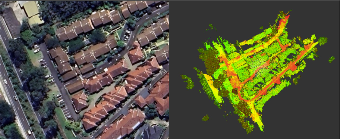
Glenaeon retirement Village | NSW
The Keyton (formerly Lendlease) owned Glenaeon Retirement Village constructed in the 1980’s with progressive upgrades underway with our involvement since 2018.
Project Type: Cadastral, Scanning & Construction
Details: Lendlease engaged TSS to deliver construction, topographic and cadastral survey services to assist the redevelopment. Notably, we were involved with the delivery of a $66M development, delivering modern living spaces for the residents in the form of 3x apartment blocks.
Total Solution: We provided a comprehensive survey control network, followed by a 3D laser scanning. Data extraction from the georeferenced point cloud enabled the creation of a detailed topographical survey for accurate design plans.